A chine is a narrow, steep-sided ravine where a stream has cut down through soft cliffs on its way to the sea. The Isle of Wight has around twenty, most of them on the exposed south-west coast. The best known are Shanklin Chine, a wooded gorge you can walk through for a fee, and Blackgang Chine, now a theme park whose original ravine has been lost to the sea.
What the word meansSection titled What the word means
"Chine" comes from the Old English cinu, a gorge or ravine. The Island Rivers Partnership, which has mapped the island's chines, gives a Saxon root meaning "a gap or yawn". The word is used for coastal gorges in central southern England: on the Isle of Wight, in Dorset (Bournemouth's Alum, Durley and Branksome Chines), in East Devon and in Hampshire, where they are sometimes called "bunnies".
How chines formSection titled How chines form
Chines form where a stream reaches the coast high above the sea and only has a short way to go across soft rock. The Island Rivers Partnership explains the process like this:
- The sea pushes the coast back. Sea levels have risen and the soft cliffs have kept retreating, shortening the island's streams.
- The stream drops steeply. With the cliff edge now close to its source, the water falls sharply to the sea.
- The water cuts down fast. In soft clays and sands, the stream carves a deep, narrow gully back into the land.
It can be quick. Island Rivers says Shepherd's Chine has eroded down 15 metres in 150 years. The position of some chines, including Shippards, Brook and Shepherd's, follows old fault lines in the rock.
Because they sit on eroding coast, chines don't last. Cliff retreat can cut off a stream and start a new chine nearby, which is how Ladder, Old Walpen and New Walpen Chines came about, and the sea can destroy one altogether, as at Blackgang.
The Isle of Wight's chinesSection titled The Isle of Wight's chines
Going clockwise round the south coast, the Island Rivers chine guide lists:
| Chine | Where | Can you visit? |
|---|---|---|
| Small Hope and Shanklin | Shanklin | Shanklin Chine is a paid attraction (below) |
| Luccombe | Between Shanklin and Ventnor | The council lists the path from the coastal path to the beach as permanently closed by land slippage |
| Blackgang | Near Chale | The ravine has been destroyed; the theme park is on the site |
| Walpen, Ladder and Whale | Chale Bay | Seen from the Coastal Path; Whale Chine's path to the beach is permanently closed |
| Shepherd's, Cowleaze and Barnes | Atherfield | Coastal Path; Island Rivers describes a steep path and steps down Shepherd's Chine |
| Grange and Marsh | Brighstone | Together the island's largest chine feature; public footpath to the beach through Grange Farm |
| Chilton | Brighstone | Car park and Coastal Path; Island Rivers recorded beach access as closed in 2014 |
| Brook and Churchill | Brook | National Trust car park and a path to Brook Bay |
| Compton and Shippards | Compton | Steps to Compton Bay, subject to landslips |
The north-west coast has more in softer, younger rocks: Alum Bay Chine, whose 185 steps lead down to Alum Bay beach, plus Widdick, Colwell, Brambles and Linstone Chines.
Parts of the Island Rivers guide date from 2014, and access on this coast changes often, so check the council's footpath closures before setting out.
Shanklin ChineSection titled Shanklin Chine
Shanklin Chine is the one to visit if you want to walk through a chine. It is a tree-lined gorge that drops 32 metres (105 feet) to sea level over just over a quarter of a mile, from Shanklin Old Village down to the Esplanade. The main waterfall falls 45 feet. It began forming about 10,000 years ago, and the stream is still cutting back towards the downs.
It has drawn paying visitors for over 200 years. William Colenutt cut the present path and opened it to the public in 1817, and Jane Austen called it "lovely" in 1813. In 1944 it carried part of PLUTO, the wartime fuel pipeline under the Channel to France; 65 yards of the pipe remain. The paths are lit up after dusk.
2026 details from Shanklin Chine:
| Price | |
|---|---|
| Adult (16 to 65) | £12.95 |
| Child (4 to 15) | £9.95 |
| Over 65 | £11.95 |
| Family (2 adults, 2 children) | £39.00 |
| Under 4 | Free |
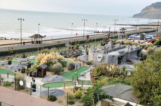
Open 26 March to 31 August, 10am to 10pm, and 1 September to 1 November 2026, 10am to 9pm (last entry 30 minutes before closing). Tickets include seven days of free returns, payment is card only, and dogs are welcome on leads. It may close in bad weather. In October 2026 the road to the top (Old Village) entrance was closed by Island Roads, with a signed diversion; you can also use the bottom entrance on the Esplanade. The Rylstone Gardens crazy golf is next to the top of the chine, and Shanklin beach is at the bottom.
Blackgang Chine: the chine the sea tookSection titled Blackgang Chine: the chine the sea took
Blackgang was once a steep ravine above Chale Bay. Alexander Dabell leased land there in 1842 and opened it to visitors in 1843, building paths down the ravine and steps to the beach. The theme park his family still runs claims to be Britain's oldest amusement park.
The ravine itself has gone. Island Rivers says rapid coastal erosion "has obliterated the chine", leaving slumped cliffs. The park says the land loses an average of 3.5 metres a year, mostly in large collapses after heavy rain, with major landslides in 1928, 1961 and 1994. An Isle of Wight Council geotechnical study describes the January 1994 slide as extensive renewed landslide activity on 170-metre-high cliffs, and concluded that managed retreat was the only viable option. The park has moved its entrance and several attractions inland over the years.
There is no public footpath into what remains of the chine and no public beach access nearby. You can see the slumped cliffs from inside the theme park, which charges entry, or from the viewpoint car park on the Military Road above it. For tickets and opening, see our theme parks guide.
Whale Chine and the Chale Bay chinesSection titled Whale Chine and the Chale Bay chines
Whale Chine is a narrow, steep-sided chine on the Military Road between Chale and Atherfield, with clearly visible rock layers and a council car park at the top. The council lists the path and steps down it (footpath C34) as permanently closed under a Traffic Regulation Order because of ongoing landslips, with no alternative route. In April 2025 the council was also monitoring the Coastal Path between Whale Chine and Grange Chine after a large landslip at Atherfield. Don't climb past barriers or use the unofficial scrambles down.
Visiting chines safelySection titled Visiting chines safely
- Respect closures. Chine paths close because the ground is moving. Check the council's rights of way closures page and obey signs on site.
- Stay away from cliff edges and the base of cliffs. Chine sides are soft clay and sand and slip without warning, especially after rain.
- Check the tide before walking along the beach between chines. Some, like Luccombe, are only reachable along the shore, and you can be cut off. Our tide times page helps.
- Don't dig into the cliffs for fossils. Loose finds on the beach are fine; see our fossil beaches guide.
- The Coastal Path links most of the south-west chines; see can you walk around the Isle of Wight.
SourcesSection titled Sources
- Island Rivers Partnership: Isle of Wight chines, including how chines were formed, Blackgang, Whale, Ladder and Walpen, Luccombe, Grange and Marsh, Shepherd's and Cowleaze and Compton and Shippards
- Wikipedia: Chine (etymology, list of chines)
- Shanklin Chine: opening times and prices (2026), origins, history and PLUTO
- Blackgang Chine: history and a unique coastal attraction (erosion rate and landslide years)
- Wikipedia: Blackgang Chine (attractions moved inland)
- Isle of Wight Council: geotechnical study area, Blackgang (2000)
- Isle of Wight Council: footpath and bridleway closures (Whale Chine C34, Luccombe SS3)
- Isle of Wight Radio: stay away warning after large West Wight landslip (21 April 2025)